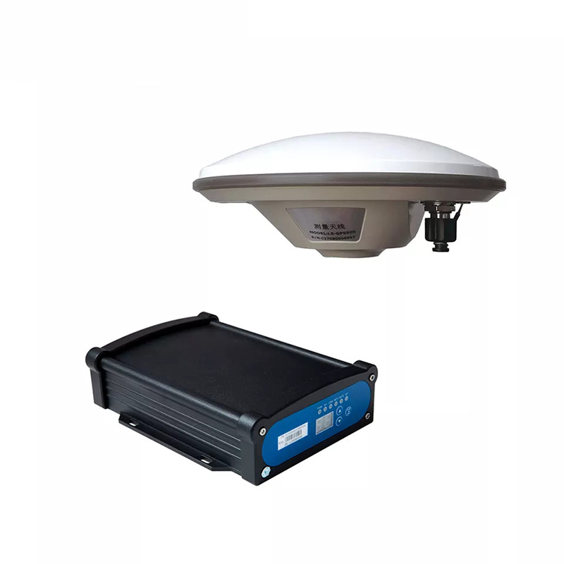
Global Navigation Satellite System (GNSS) Receivers are instrumental in surveying and geospatial mapping. These devices leverage satellite signals to provide highly accurate position, navigation, and timing information, making them indispensable for geospatial sciences professionals. From mapping expansive terrains to ensuring precise alignment in construction projects,
GNSS receivers have significantly elevated these industries’ accuracy, efficiency, and productivity.
This article explores how GNSS receivers are transforming surveying and geospatial mapping, the benefits they offer, and their diverse applications across multiple sectors.
The Evolution of Surveying and Mapping Technology
Traditional surveying methods, like the use of theodolites and tape measures, were time-consuming, labor-intensive, and prone to human error. However, with the advent of GNSS technology, surveying has undergone a revolutionary change. GNSS receivers are now able to pinpoint positions with centimeter-level accuracy, making them ideal for applications where precision is critical.
The transition from analog to digital technologies, coupled with the integration of GNSS receivers, has made geospatial data collection faster and more reliable. Surveyors and mapping professionals can now gather more data in less time, ensuring high-quality results with minimal rework.
How GNSS Receivers Work in Surveying
GNSS receivers work by communicating with multiple satellites in orbit. By calculating the time it takes for the satellite signals to reach the receiver, they determine the exact position on the Earth’s surface. GNSS technology utilizes systems like GPS (Global Positioning System), GLONASS (Russia), Galileo (Europe), and BeiDou (China), to provide comprehensive global coverage.
For surveying and mapping, professionals often use Real-Time Kinematic (RTK) positioning and Post-Processing Kinematic (PPK) methods, which are advanced GNSS techniques that offer sub-centimeter-level accuracy. RTK, for example, corrects real-time GNSS signals by referencing a nearby base station, providing surveyors with instantaneous, high-precision coordinates.
Applications of GNSS Receivers in Surveying and Mapping
GNSS receivers have a broad range of applications in surveying and geospatial mapping, including:
Topographic Surveys: Mapping out the features of a terrain, such as elevation changes and land boundaries, is made easier and more accurate with GNSS receivers.
Construction Surveying: Ensuring proper alignment and layout of structures like roads, bridges, and buildings relies on the precision of GNSS receivers.
Cadastral Surveys: Defining land ownership boundaries can be accomplished more quickly and with fewer errors using high-accuracy GNSS technology.
Geodetic Surveys: GNSS receivers help measure the Earth’s shape, orientation in space, and gravitational field, making them crucial for scientific research and geodesy.
Utility Mapping: Mapping underground utilities, such as water pipes and electrical cables, is simplified using GNSS receivers, reducing the risk of damaging existing infrastructure.
Advantages of Using GNSS Receivers in Surveying and Mapping
Implementing GNSS receivers in surveying offers numerous benefits:
High Precision and Accuracy: With advanced techniques like RTK and PPK, GNSS receivers can achieve centimeter-level accuracy, ensuring reliable results for critical projects.
Increased Efficiency: GNSS-based surveys are faster, enabling professionals to cover larger areas in less time compared to traditional methods.
Cost Savings: The speed and accuracy of GNSS receivers reduce the need for repeated surveys, saving both time and money.
Improved Safety: Surveying in hazardous or difficult-to-reach areas is safer with GNSS technology, as receivers can be mounted on drones or autonomous vehicles.
Versatility: GNSS receivers can be used in various environments, from dense urban areas to remote locations, making them versatile tools for multiple surveying scenarios.
Real-World Examples of GNSS Receiver Applications
Land Development Projects: GNSS receivers play a key role in urban
planning and land development. For example, they are used to map out new roads, define property boundaries, and ensure the precise placement of infrastructure.
Mining Surveys: In the mining industry, GNSS technology is used to create 3D maps of mine sites, helping in planning and resource extraction.
Environmental Monitoring: GNSS receivers contribute to tracking and managing environmental changes, such as coastline erosion or deforestation.
Disaster Management: GNSS receivers assist in creating accurate maps of affected areas after natural disasters, aiding rescue and relief efforts.
Innovations and Future Trends in GNSS Technology
As technology advances, GNSS receivers are becoming even more sophisticated. Modern receivers now integrate multiple GNSS constellations for enhanced reliability, even in challenging environments. Additionally, the adoption of multi-frequency and multi-constellation support has reduced signal interference, making GNSS receivers more effective in urban canyons or under heavy foliage.
Emerging trends include the use of integrated GNSS and Inertial Navigation Systems (INS) for improved accuracy and the development of miniaturized GNSS receivers for use in small drones and wearable devices. The continued evolution of GNSS technology is expected to make geospatial mapping even more accessible and precise.
Conclusion: The Future of Surveying with GNSS Receivers
GNSS receivers have become essential tools in surveying and geospatial mapping, driving innovation and enhancing accuracy in diverse applications. From land development to environmental monitoring, these devices are transforming how professionals collect and analyze spatial data.
With ongoing advancements in GNSS technology, such as improved signal processing and integration with other geospatial tools, the future of surveying looks promising. As GNSS receivers continue to evolve, they will remain at the forefront of geospatial innovation, helping surveyors and mapping professionals navigate the complexities of modern projects with confidence and precision.